


Weld 232, Weld County, Colorado
About
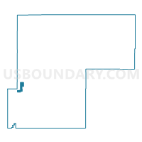
Outline

Summary
| Unique Area Identifier | 549352 |
| Name | Weld 232 |
| County | Weld County |
| State | Colorado |
| Area (square miles) | 10.00 |
| Land Area (square miles) | 9.92 |
| Water Area (square miles) | 0.08 |
| % of Land Area | 99.17 |
| % of Water Area | 0.83 |
| Latitude of the Internal Point | 40.37238910 |
| Longtitude of the Internal Point | -104.90215870 |
Maps


Graphs
Select a template below for downloading or customizing gragh for Weld 232, Weld County, Colorado


Neighbors
Neighoring Voting District (by Name) Neighboring Voting District on the Map
- Weld 129, Weld County, CO
- Weld 213, Weld County, CO
- Weld 224, Weld County, CO
- Weld 228, Weld County, CO
- Weld 230, Weld County, CO
- Weld 231, Weld County, CO
- Weld 244, Weld County, CO
- Weld 247, Weld County, CO
Top 10 Neighboring County Subdivision (by Population) Neighboring County Subdivision on the Map
Top 10 Neighboring Place (by Population) Neighboring Place on the Map
Top 10 Neighboring Unified School District (by Population) Neighboring Unified School District on the Map
Top 10 Neighboring State Legislative District Lower Chamber (by Population) Neighboring State Legislative District Lower Chamber on the Map
Top 10 Neighboring State Legislative District Upper Chamber (by Population) Neighboring State Legislative District Upper Chamber on the Map
Top 10 Neighboring 111th Congressional District (by Population) Neighboring 111th Congressional District on the Map
Top 10 Neighboring Census Tract (by Population) Neighboring Census Tract on the Map
- Census Tract 21.02, Weld County, CO (9,989)
- Census Tract 21.03, Weld County, CO (8,009)
- Census Tract 21.01, Weld County, CO (7,319)
- Census Tract 22.09, Weld County, CO (904)
- Census Tract 22.10, Weld County, CO (783)